Siargao Island
Location
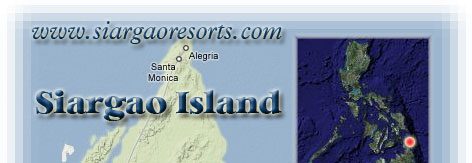
Siargao Island is politically under the jurisdiction
of Surigao del Norte, a province located at the Northeastern
portion of Mindanao which lies between 125 50’ East Longitude
and betweem 9 30’ and 10 0.5’ North Latitude.
It is bounded on the north by Dinagat Island,
on the south by mainland part of the Province of Surigao del
Norte, on the east by Hinatuan Passage, and on the west by Surigao
Strait and the province of Southern Leyte. Stretching along
its southeastern coast is the Philippine Deep, the greatest
known depth within Philippine waters at 11,094 meters below
sea level.
Area
Siargao Island has an approximate land area
of 67,726 hectares including Bucas Grande Island Island and
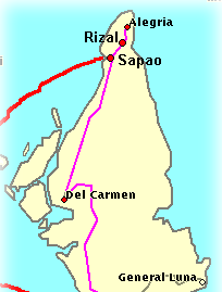
all coastal barangays. It consists of nine (9) municipalities
with 131 barangays.
Climate
The prevailing climate type of the island falls
under Type II which is characterized by no pronounced dry season
but with a very pronounced maximum rainfall from November to
January. Siargao receives the highest amount of rainfall during
December while June is the driest month.
How to get there!!!
From Manila, there are daily flights to Cebu,
then connect with either the Supercat fast ferry or any regular
passenger boats to Surigao City. There is also a daily flight
to nearby Butuan City via Philippine Airlines , then a 2 ½
hr.-bus ride to Surigao City.
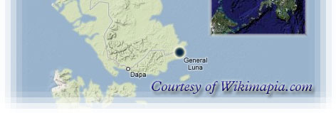
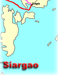
Upon reaching Surigao City, there are daily
fast craft transfers to Dapa town in Surigao Island; then a
short jeepney or motorcycle ride to General Luna town, the surf
site.
Boats also ply the Manila-Surigao and Cebu-Surigao
route.
Route 1:
Manila > Cebu City > Surigao City > Siargao Island
Route 2:
Manila > Butuan City > Surigao City > Siargao Island